
- Warning Specifics: A Met Office yellow thunderstorm warning for London and the South East is in place for Friday, 28 August 2026, with a significant focus on Oxfordshire.
- Timing: The alert remains active between 11:00 and 20:00, with forecasted conditions including lightning, hail, and sudden flooding.
Met Office Issues Yellow Warning of Thunderstorm Affecting South East
The Met Office has officially issued a weather alert for Friday, 28 August 2026, as a yellow thunderstorm warning affecting Oxfordshire and the wider South East region comes into force. Forecasters have indicated that atmospheric instability will likely lead to heavy downpours and electrical activity across the afternoon and early evening.
The warning is scheduled to remain active from 11:00 until 20:00. While the alert covers a broad area, including London and the home counties, meteorological data suggests a specific focus on Oxfordshire. Residents are advised to monitor the Met Office: UK Weather Warnings portal for real-time updates as storm cells develop.
Atmospheric Conditions and Humidity
Meteorologists state that the weather on 28 August is expected to be notably humid, creating the necessary energy for significant storm development. Temperatures in Oxfordshire and surrounding areas are forecasted to reach peaks of approximately 22°C to 24°C. This warmth, combined with high moisture levels, is anticipated to trigger intense localised rainfall.
Expected conditions throughout the warning period include not only heavy rain but also lightning strikes and hail. Although some areas may see little rainfall, those caught under the centre of the storm cells could experience rapid accumulations of water. While Oxfordshire is the primary concern for this specific alert, residents further south should remain aware of the Chichester storm warning and general regional patterns that often impact West Sussex and the coast.
Transport Disruptions and Public Safety
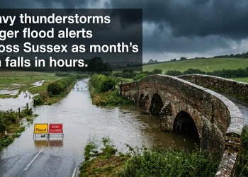
The potential for sudden flooding poses a risk to local infrastructure. Authorities have warned that spray and standing water on roads may lead to difficult driving conditions and increased journey times. There is a verified risk of sudden flooding causing temporary road closures, which could impact arterial routes across the South East.
Public transport users are also encouraged to check their routes before travelling. Potential delays to bus and train services are anticipated if lightning strikes damage signalling equipment or if tracks become submerged. Commuters can find the latest information via National Rail: Service Disruptions. Furthermore, the Met Office has noted the possibility of short-term power outages if utility lines are affected by electrical activity.
Flood Risk and Infrastructure
While the focus remains on the immediate threat of thunderstorms, long-term saturation levels are being monitored. Although there are currently zero severe warnings in West Sussex regarding river flooding, the sudden nature of convective rainfall can lead to surface water issues in urban environments. Property owners in Oxfordshire are advised to check for flooding risks via official government channels, particularly in areas prone to poor drainage.
The Met Office suggests that as the storm cells move across the region, the intensity of the rainfall may vary significantly over short distances. Public safety remains the priority, and individuals are urged to seek shelter during periods of active lightning and to avoid driving through floodwaters of unknown depth.